permaculture@lists.ibiblio.org
Subject: permaculture
List archive
[permaculture] Thread on tree planting on keylines using GIS, tractor with planter, Keyline plough or subsoiler (big difference) found in FB agroforestry group
- From: Lawrence London <lfljvenaura@gmail.com>
- To: permaculture <permaculture@lists.ibiblio.org>
- Subject: [permaculture] Thread on tree planting on keylines using GIS, tractor with planter, Keyline plough or subsoiler (big difference) found in FB agroforestry group
- Date: Tue, 9 Aug 2022 10:50:43 -0700
Thread on tree planting on keylines using GIS, tractor with planter,
Keyline plough or subsoiler (big difference) found in FB agroforestry group
-
Agroforestry
<https://www.facebook.com/groups/716795725512043/?hoisted_section_header_type=recently_seen&multi_permalinks=1414040809120861&__cft__[0]=AZWrGLZx1nLdhzdQzHO0LdOoo2f3lCSq6schjHih_HRzLa0LoW_9t5v-_Woi52UluN39ei_I6s7Yd0oOXd_0Qqf9fj74_qjvKKvGZf2v1JHk36JokporDG12692Pm6Rzad3VfgelFENyfje1B_t4FVLvhwb4dynym-ARoWiBT4apC-1Ju2WX0eECzWJc9oWK5pg&__tn__=-UC%2CP-R>
(Question)
What's the most efficient way to mark keyline planting rows on a large
scale?
I have used laser level and flags before but I need something faster. I am
willing to invest in technology to help but don't know where to start.
(Answers)
Get someone with GIS experience to make you a map (I can make a
recommendation for this if you'd like). Then you can go out on foot with a
GPS unit (I use an arrow 100 that is fine, just slow) and mark the lines
with marking paint. Then install how you see fit.
after marking your first offset contour lines just feel if the tractor is
going up or down and adjust accordingly
It’s easy once you get the hang of it
We have 2 row and 4 row or single row planters on RTK / GPS
Depending, I also create georeferenced maps for this type of work. I just
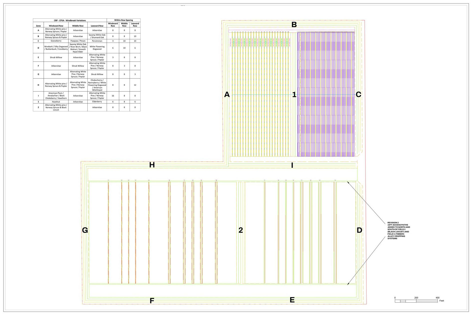
finished up designing a 120 acre Alley Cropping site in IL for my employer
and operated the GIS guided tractor one morning planting 800 trees in 4hrs.
Same process for planting by hand. Also depending, you may want or need to
bring a relay device onto the field for better accuracy. I've also done the
laser level and flagging, followed by a tractor pulling a single shank
subsoiler.
I can also create georeferenced maps for projects like this and have
assisted Eliza in the past. Several months ago, between CAD and GIS, I
drafted a 120 acre Alley Cropping site for my employer.
[image: GIS-PLAN-KeylinePlantings.jpg]
--
Lawrence F. London, Jr.
lfljvenaura@gmail.com
-
[permaculture] Thread on tree planting on keylines using GIS, tractor with planter, Keyline plough or subsoiler (big difference) found in FB agroforestry group,
Lawrence London, 08/09/2022
-
[permaculture] Unsubscribe,
Mary Beth Berkley, 08/09/2022
- Re: [permaculture] Unsubscribe, Lawrence London, 08/09/2022
- Re: [permaculture] Unsubscribe, PA Communications, 08/10/2022
-
[permaculture] Unsubscribe,
Mary Beth Berkley, 08/09/2022
Archive powered by MHonArc 2.6.24.
